THE VOICE OF INTERNATIONAL LITHUANIA
|
VilNews has its own Google archive! Type a word in the above search box to find any article.
You can also follow us on Facebook. We have two different pages. Click to open and join.
 Click on the buttons to open and read each of VilNews' 18 sub-sections Click on the buttons to open and read each of VilNews' 18 sub-sections  |

|


EUROPE – MY HOME & MY CASTLE (6 of 10)
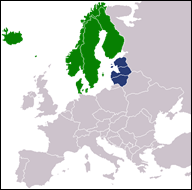
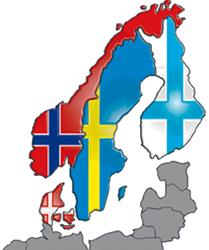
Scandinavia & Finland
|
VilNews is on its way around Europe!
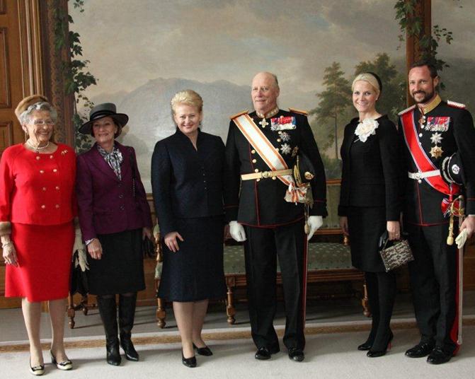
Lithuanian President Dalia Grybauskaitė on a two-day state visit to Norway in 2011. The President was officially Today's tour starts in the far north of Norway, and continues south Tour guide: Aage Myhre
|
|
|
|
|
|
Lithuania’s best future lies in a Nordic union
New collaboration constellations are forming in our today’s Europe, very much due to the financial crisis. This new approach, between countries that previously were relatively far apart, as well as the so-called G-8 and G-20 alliances between the world's richest countries are examples of how we seem to be moving into a new World Order. Also in good old Europe we are now beginning to develop entirely new constellations. Typical of such constellations is that the largest and richest countries take initiatives to secure their own positions and welfare, while smaller countries often have to put up with playing second fiddle. What the three Baltic States now face is that being members of the EU is not enough. The economic crisis, and partly also questions on defence and security, have led to new forms of cooperation, as the aforementioned , and our small nations far north in Europe are not invited to become active participants. It is therefore my opinion that a tight collaboration with the other Nordic countries is the way to go. Together we are large enough to be heard and our common identity and cultural background is a good basis for cooperation. In the 13th century, an alliance of Northern European towns called the Hanseatic League created what historian Fernand Braudel called a “common civilization created by trading.” Today’s expanded list of Hansa states share Germanic and Scandinavian cultural roots. Germany and the Scandinavian countries have found their niches by selling high-value goods to developed nations, as well as to burgeoning markets in Russia, China, and India.
Widely admired for their generous welfare systems, Denmark, Finland, Norway, Sweden and Germany have liberalized their economies in recent years. They account for six of the top eight countries on the Legatum Prosperity Index and boast some of the world’s highest savings rates (25 percent or more), as well as impressive levels of employment, education, and technological innovation. “In strategies that we are developing for the next twenty years emphasize that it is important for the Baltic States to become more harmonized and catch up with Scandinavian countries. Integration with Nordic countries is an important objective,” said Andrius Kubilius, Lithuania’s prime minister, in a meeting in Tallinn last year. I think he is right.
|
|
|
|
The Nordic model The Nordic model refers to the economic and social models of the Nordic countries (Denmark, Iceland, Norway, Sweden and Finland). This particular adaptation of the mixed market economy is characterised by "universalist" welfare states (relative to other developed countries), which are aimed specifically at enhancing individual autonomy, ensuring the universal provision of basic human rights and stabilising the economy. It is distinguished from other welfare states with similar goals by its emphasis on maximising labour force participation, promoting gender equality, egalitarian and extensive benefit levels, large magnitude of redistribution, and liberal use of expansionary fiscal policy. “America’s social model is flawed, but so is France’s,” the Parisian newspaper Le Monde recently wrote. According to Le Monde Europe should adopt the “Scandinavian model,” which is said to combine the economic efficiency of the Anglo-Saxon social model with the welfare state benefits of the continental European ones. |
Our today’s journey:
|
|
Norway – oil, fjords, fish & ships |
|
|
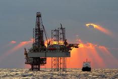
Norway, officially the Kingdom of Norway, is a Nordic unitary constitutional monarchy, with King Harald V as its head of state, whose territory comprises the western portion of the Scandinavian Peninsula, Jan Mayen, and the Arctic archipelago of Svalbard. Norway has a total area of 385,252 square kilometres (148,747 sq mi) and a population of about five million. Norway's extensive coastline, facing the North Atlantic Ocean and the Barents Sea, is home to its famous fjords. Two centuries of Viking raids tapered off following the adoption of Christianity by King Olav Tryggvason in 994. A period of civil war ended in the 13th century when Norway expanded its control overseas to parts of the British Isles, Iceland, and Greenland. Norwegian territorial power peaked in 1265, but competition from the Hanseatic League and the spread of the Black Death weakened the country. In 1380, Norway was absorbed into a union with Denmark that lasted more than four centuries. In 1814, Norwegians resisted the cession of their country to Sweden and adopted a new constitution. Sweden then invaded Norway but agreed to let Norway keep its constitution in return for accepting the union under a Swedish king. Rising nationalism throughout the 19th century led to a 1905 referendum granting Norway independence. Discovery of oil and gas in adjacent waters in the late 1960s boosted Norway's economic fortunes. In referenda held in 1972 and 1994, Norway rejected joining the EU. The Sámi people have a certain amount of self-determination and influence over traditional territories through the Sámi Parliament and the Finnmark Act. Although having rejected European Union membership in two referenda, Norway maintains close ties with the union and its member countries, as well as with the United States. Norway remains one of the biggest financial contributors to the United Nations, and participates with UN forces in international missions, notably in Afghanistan, Kosovo, Sudan and Libya. Norway has extensive reserves of petroleum, natural gas, minerals, lumber, seafood, fresh water, and hydropower. On a per-capita basis, it is the world's largest producer of oil and natural gas outside the Middle East, and the petroleum industry accounts for around a quarter of the country's gross domestic product. The country maintains a Nordic welfare model with universal health care, subsidized higher education, and a comprehensive social security system. Norway has the world’s highest human development index ranking. Norway’s merchant fleet is among the biggest in the world. Norwegian companies control approximately 23% of the world's cruise vessels, 19% of the world's gas carriers, 19% of the world's chemical tankers and 10.5% of the world's crude oil tankers. |
|
|
|
|
|
|
|
|
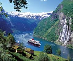
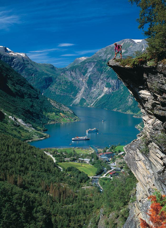
The Geiranger Fjord at Norway’s west-coast is a 15-kilometre (9.3 mi) long branch of the Storfjord (Great Fjord). The small village of Geiranger is located at the end of the fjord where the Geirangelva river empties into it.
The fjord is one of Norway's most visited tourist sites.
Photo: www.allempires.net
Our today’s trip starts in the Barents Sea – between Norway and the North Pole
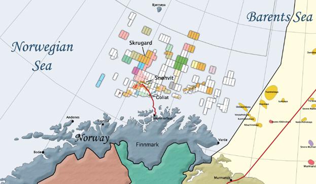
Oil and gas exploration in the Barents Sea began in the 1970s. Discoveries were made on both the Russian and Norwegian sides. The first major producing field is Snøhvit in the Norwegian sector. The largest discovery to date is the Shtokman field in the Russian sector. For decades there was a boundary dispute between Norway and Russia, with the Norwegians favouring the Median Line and the Russians favouring a meridian based sector. A compromise treaty announced 27 April 2010 settled the border in the approximate middle of these two stances. Snøhvit (Snøhvit means Snow White in Norwegian) is the name of a natural gas field situated 140 kilometres (87 mi) northwest of Hammerfest, Europe's northernmost town. The gas from Snøhvit is being used for LNG production at Melkøya close to Hammerfest. The total costs of field development will be around NOK 34.2 billion ($ 6 billion).
North Cape – on the very top of Norway and Europe
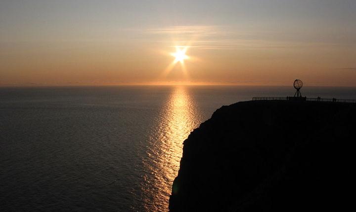
Midnight sun at North Cape, a cape on the island of Magerøya in Northern Norway. Its 307 metres (1,007 ft) high, steep cliff is often referred to as the northernmost point of Europe, located at 71°10′21″N 25°47′40″E, 2,102.3 kilometres (1,306.3 mi) from the North Pole.
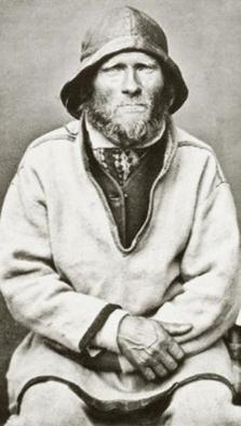
Finnmark County – where Sámi (Lappish) people and reindeers live…
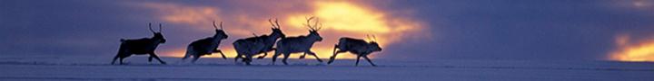
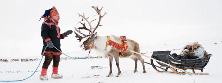
We move from the rough coast, to the inner parts of Finnmark, where many Sámi families are actively engaged with huge reindeer herds year round. The Sami are indigenous people who came to Norway more than 10 000 years ago.
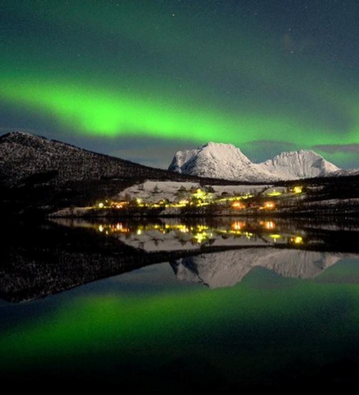
Tromsø – the world’s northern light capital…
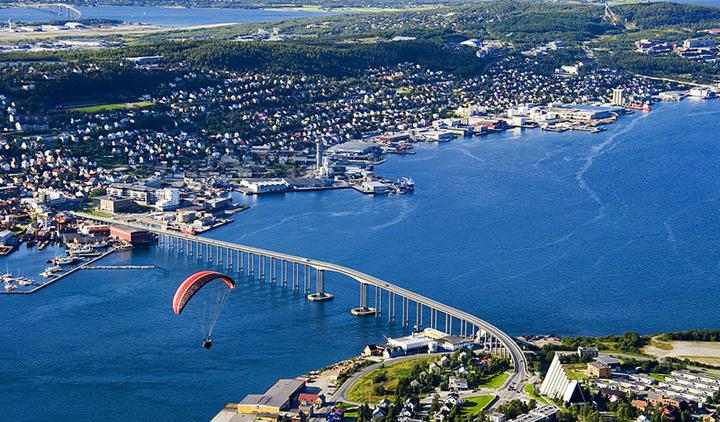
Tromsø is the capital of North Norway also called the world's northern lights capital. Here you will also find the world's
northernmost university, including an advanced northern lights observatory. International airport in the city centre!
|
|
Welcome to my birthplace Olaheim at the Senja island! Here, in the tiny village of Olaheim on the island of Senja in Northern Norway, I grew up in the 1950s. At that time we had neither running water nor electricity in the house. We survived on hunting, fishing and a small farm with one cow and a handful of goats and sheep. No road access to the rest of the world. Today this is a completely different, far more modern community with facilities and standards as the rest of Norway. You are welcome to visit. I'm taking you with me for fishing in the lake right by, or in the ocean off the island. Or how about a trip up in the vast mountains, some of which are a thousand meters high, plummeting straight down into the many Senja fjords? |
My home place Olahaeim at the island of Senja.
Photo by the world famous Senja photographer Hugo Løhre.
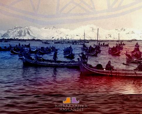
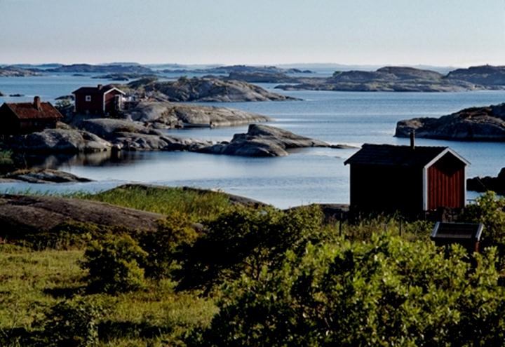
Lofoten has the world’s best waters for cod fishing
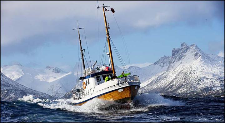
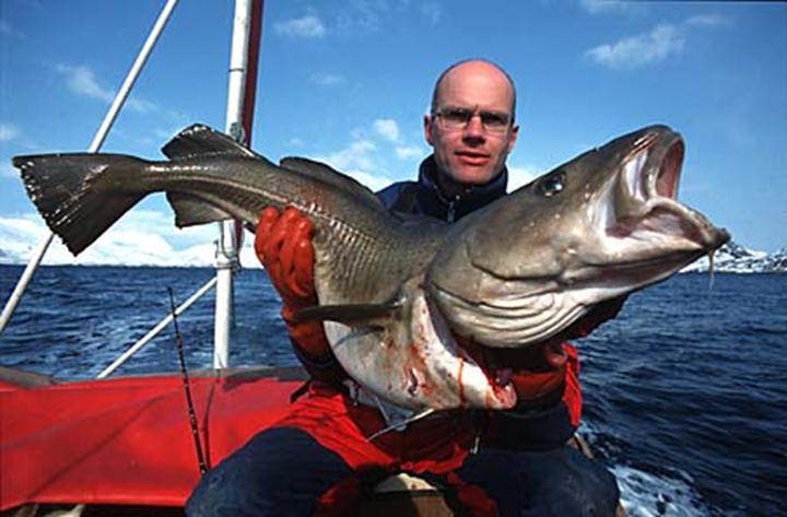
Lofoten is an archipelago and a traditional district in the county of Nordland, North Norway. Though lying within the Arctic Circle, the archipelago experiences one of the world's largest elevated temperature anomalies relative to its high latitude. The islands have for more than 1,000 years been the centre of great cod fisheries, especially in winter, when the cod migrates south from the Barents Sea and gathers in Lofoten to spawn. Bergen in southwestern Norway was for a long time the hub for further export south to large parts of Europe, particularly so when trade was controlled by the Hanseatic League.
|
It is among the indigenous people that the answers are to be found
"The wisdom of the future comes from the north. That’s what our ancestors told us." The Mayan Indian in front of me is talking very seriously. Looking me straight in the eyes. He, a true child of the world's most famous indigenous people. From the south. Me a person with just a hint of Sami blood. From the north. The indigenous people's ability to 'see' more and deeper than the more modern versions within humanity is a resource that has been little exploited. More mocked and made fun of. Indigenous peoples' close contact with their ‘other dimension’ has often been regarded as ravings. The people of today find it hard to believe that people have qualities that cannot be explained by reason. But perhaps it is rather the understanding of the concept of 'common sense' there is something wrong with? That way he could he predict the hunting and fishing outcomes, tell people about their physical and spiritual life. Present, past and future. Nature's soul speaking through the shaman.
|
Is Trondheim, where I studied architecture, the most ideal city in the world?
|
|
"Trondheim is the world's most ideal city." This was the conclusion of a U.S. research group that travelled around the world to find the ideal city. The group's report highlighted that Trondheim is a 'mini-city' of adequate size, with wide streets, low buildings, good air, a small, efficient centre core and glorious surroundings. Not bad certificate for the city that was my home for several years... Trondheim is Norway's capital of technology, a lively and historical university town, and home to the Nidarosdomen Cathedral. With a population of about 165,000, Trondheim counts itself as Norway's third largest city.
|
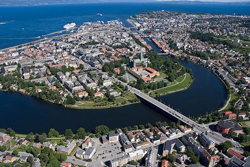
Trondheim is a green, beautiful city in Mid Norway. The city's Old Town, Midtbyen, is located on a peninsula formed by the river Nidelven, before it flows into the Trondheim Fjord and ends its long, wet journey from Selbusjøen southeast in the county. Scandinavia's largest church, the Nidarosdomen Cathedral is seen in the middle of the picture.
Photo: Aage Hojem, Trondheim Havn.
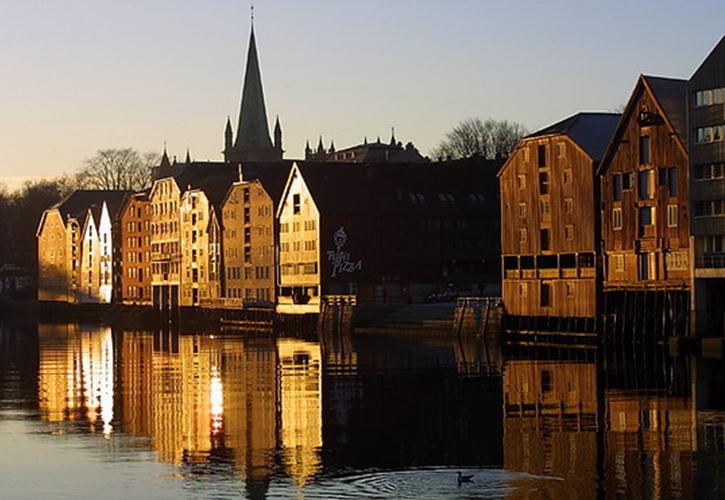
Wooden warehouses at the Nidelven river bank in the centre of Trondheim. There has been warehouses like these here since the Middle Ages. The oldest surviving ones are from the mid 1700's.
Foto: Trondheim.no.
Oslo – home of the Vikings and the world’s largest sculpture park
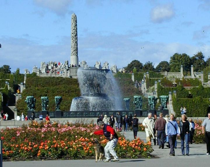
The Vigeland Park in Oslo is the world's largest sculpture park made by a single artist, and is one of Norway's most popular tourist attractions. The park is open to visitors all year round. The unique sculpture park is Gustav Vigeland's lifework with more than 200 sculptures in bronze, granite and wrought iron. Vigeland was also in charge of the design and architechtural layout of the park. The Vigeland Park was mainly completed between 1939 and 1949. Most of the sculptures are placed in five units along an 850 meter long axis: The Main gate, the Bridge with the Children's playground, the Fountain, the Monolith plateau and the Wheel of Life.
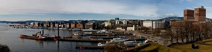
The capital of Norway is also its largest city. It has over 600,000 inhabitants and covers 454 square kilometres, 242 of which are forests. The city is located at the head of the 100-kilometre Oslofjord. The fjord’s 40 islands are great for recreation, and many of them can be reached by ferry. Over half of the municipality of Oslo is covered by forests and parks, making Oslo a truly green city, where opportunities for outdoor recreation are always nearby.
Oslo’s climate is milder than its latitude might indicate. Summer temperatures often equal those of cities much further south, yet the winters are usually cold enough to make Oslo a great skiing destination.
The prestigious Nobel Peace Prize is awarded annually on 10 December in Oslo City Hall.
|
|
Denmark – food, culture & energy |
|
|
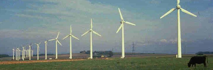
The countries of Denmark and Greenland, as well as the Faroe Islands, constitute the Kingdom of Denmark. Denmark consists of a large peninsula, Jutland (Jylland) and many islands, most notably Zealand (Sjælland), Funen (Fyn), Vendsyssel-Thy (commonly considered a part of Jutland), Lolland, Falster and Bornholm, as well as hundreds of minor islands often referred to as the Danish Archipelago. Denmark has long controlled the approach to the Baltic Sea (dominium maris baltici); before the digging of the Kiel Canal, water passage to the Baltic Sea was possible only through the three channels known as the "Danish straits". Denmark is a constitutional monarchy with a parliamentary system of government. It has a state-level government and local governments in 98 municipalities. Denmark has been a member of the European Union since 1973, although it has not joined the Eurozone. Denmark, with a mixed market economy and a large welfare state, ranks as having the world's highest level of income equality. It has frequently ranked as the happiest and least corrupt country in the world. The national language, Danish, is closely related to Swedish and Norwegian, with which it shares strong cultural and historical ties. Danish cuisine, originating from the peasant population's own local produce, was enhanced by cooking techniques developed in the late 19th century and the wider availability of goods after the Industrial Revolution. The open sandwiches, known as smørrebrød, which in their basic form are the usual fare for lunch, can be considered a national speciality when prepared and decorated with a variety of fine ingredients. Hot meals traditionally consist of ground meats, such as frikadeller (meat balls), or of more substantial meat and fish dishes such as flæskesteg (roast pork with crackling) or kogt torsk (poached cod) with mustard sauce and trimmings. Denmark is known for its Carlsberg and Tuborg beers and for its akvavit and bitters although imported wine is now gaining popularity. Danish chefs, inspired by continental practices, have in recent years developed an innovative series of gourmet dishes based on high-quality local produce. As a result, Copenhagen and the provinces now have a considerable number of highly acclaimed restaurants, of which several have been awarded Michelin stars. The Noma restaurant in Copenhagen is a two Michelin star restaurant run by chef René Redzepi. The name is an acronym of the two Danish words "nordisk" (Nordic) and "mad" (food), and the restaurant is known for its reinvention and interpretation of the Nordic Cuisine. In both 2010 and 2011, it was ranked as the Best Restaurant in the World. In 1973, during the Yom Kippur war, Denmark was 98% dependent on foreign oil for its power. Today, thirty-two years later, the country derives 21% of its energy from wind and is a net exporter of energy. |
|
|
|
|
|
|
|
|
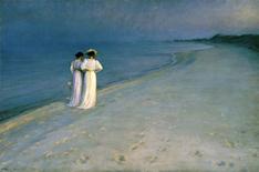
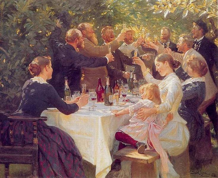
“Hipp Hipp Hurra!” by the Danish/Norwegian painter Peder Krøyer (1851-1909), the ringleader of a group of
genre painters who gathered in the Danish fishing village of Skagen.
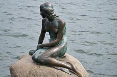
Copenhagen – Scandinavia’s cosmopolitan city
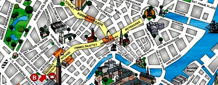
Strøget 'in Copenhagen is considered the world's oldest and longest pedestrian street.
Photo: Copenhagenet.dk.
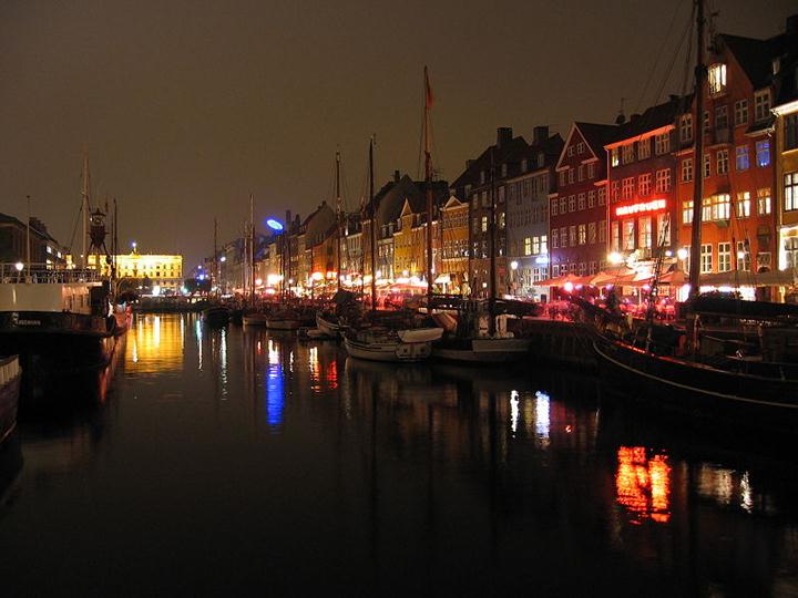
Nyhavn is part of the original Copenhagen Harbour all the way back to the founding of Haven, as
Copenhagen was called in the 12th century.
"I am not an Athenian, or a Greek, but a citizen of the world," said Socrates. That is Copenhagen in a nutshell. My favourite Scandinavian city, a world city where people are more laid-back, where the famous Danish 'grin' is never far away. Where shops are permitted to sell alcohol, and even exhibit the bottles in their windows. Miles away from the Swedish and Norwegian chastity. The old buildings have been standing here for hundreds of years. Copenhagen represents majestic dignity, but has also a fine-meshed network of narrow streets, small squares and architectural details that often dates back to the Middle Ages.
Copenhagen's city council decided in 1962 to establish a car-free pedestrian street from City Hall Square in the west to the Kongens Nytorv in the eastern part of the town. The world's first pedestrian-revolution was called "Strøget". Not just one street, but a maze of alleyways and historic sites, with a total length of over 3 km, the oldest and longest pedestrian system in the world. Nygaden, Vimmelskaftet and Østergade, the main thoroughfare, is winding between the beautiful old buildings. Known, loved shops and restaurants on both sides. The people flow waves back and forth. Day and night.
Summer and winter. This is what I call a vibrant city!
The pubs and restaurants at Gråbrødretorv, Kongens Nytorv, and along both quaysides in Nyhavn are as genial as the Danes themselves. Hviids Vinstue at Kongens Nytorv is a must for me when I'm in Copenhagen. With a few drops of ‘Gammel Dansk (Old Danish)'. Then a 'smørrebrød’ with herring. Or liver and bacon. A foaming Bajer belongs to the meal. The narrow and dark rooms in Hviids Vinstue have witnessed the dramatic historical events over nearly 300 years. It sits in the walls.
The restaurant St. Gertrud's Kloster experienced as a journey back to medieval times. Narrow basement times and restaurant rooms over several floors. All in spartan monastic style, only lit by candles under the brick-vaults. On Gråbrødretorv I have two favourites: The restaurants Peder Oxe and Bof & Ost. Rustic taverns with a relaxed square. Salad Tables and tender beef. Copenhagen at its best.
Copenhagen is the Danish capital and Scandinavian’s largest city. Copenhagen was founded by the Danish bishop Absalon in 1167 - who built a little fortress on a small isle outside of the growing town that today is inhabited with over 1.8 million people and is an international metropolis with the biggest airport in northern Europe. In Copenhagen the Danish parliament is located together with the Royal residence Amalienborg - as the capital became a regal city in 1443.
|
|
Sweden – technology & islands |
Sweden is the biggest country of Northern Europe and the fifth of whole Europe. With 449,964 sq km (173,732 sq mi) it is almost as big as Spain or France. But it has a completely different shape. The extreme distance from north to south in Sweden is about 1,575 km (about 980 mi). If you turn Sweden around at the southern end, you will see the north end up as south as Naples in Italy. The distance from east to west is only 500 km (about 310 mi).
Almost 9 million people live in this long-shaped country. With such a small population it is not a surprise this vast country is dominated by nature. One of the main facts about Sweden for tourists to remember is that Sweden is not a country for sensation-seekers.
Instead it is perfect for those who love nature, space, clean air, beautiful landscapes and outdoor activities. Great sceneries are among the major tourist attractions.
The more you get to the north the landscape becomes wilder, with ever bigger forests and literally thousands of lakes.
The north (Lapland) is often called the last wilderness in Europe, with high mountains, swamps and wild rivers, treeless highlands and impenetrable birch forests. In this part of Sweden the Saami live, also called the Lapps, one of the last nomad peoples in Europe.
Although at a very northern latitude, Sweden has a moderate climate. It has rainfall in spring, summer and fall, but never very much. In winter there is always snowfall. It is freezing cold then, especially in the northern parts of the country. The summers are sunny with an average temperature of 22°C (71°F). Daylight hours increase in summer and decrease in winter.
Sweden is a monarchy, now ruled by king Carl GustavXVI. In reality his function is purely ceremonial. The country is governed by a democratically chosen parliament. Social-democrats are traditionally the main political force, with the Moderate Party in second place.
The crown or krona is the Swedish currency. Sweden has a tradition of pacifism. It is the only European state that was not involved in any armed conflict for almost 200 years.
Kista - Sweden´s IT Capital
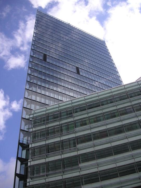
Kista Science Tower.
They call it Wireless Valley, Mobile Valley or the Silicon Valley of the North. Its formal name is Kista Science City, located in north-west Stockholm. It’s where you’ll find many of the world’s foremost ICT* companies, gathered together to take advantage of Sweden’s strong position in mobile communications. Kista Science City is one of the world’s leading high-tech clusters.
The Kista urban area is Sweden’s biggest corporate centre. Here are more companies and employees within a limited space than anywhere else in the country. Of the nearly 28,000 employees in some 750 Kista companies, two-thirds work in the ICT sector. Here is everything from the major international enterprise to the small, entrepreneur owned ICT business. Ericsson has its head office in Kista and is the largest single employer with a staff of more than 9,000.
Kista Science City is located centrally in the Stockholm region, 15 minutes from Central Station on the underground railway and 15 minutes from the main Stockholm airport at Arlanda. It also has the advantage of being close to Sweden’s financial centre in central Stockholm.
Companies and researchers are found along the entire value chain within wireless systems, mobile services and broadband systems - the three strategic areas for Kista Science City.
Stockholm – the city of thousand Islands
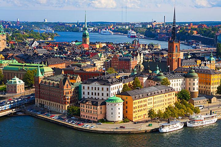
Post-war Stockholm makes me think that architects, urban planners and reform eager politicians too often lack the ability to see connections, physical and in a time perspective. How on earth could a beautiful city like this otherwise be so much destroyed around 1960? The world's worst city destruction ever, it is said, bombings and wars included. The ideas of the Swiss-French architect Le Corbusier, by some called the 20century's foremost, destroyed the good old Stockholm.
Only Gamla Stan and certain enclaves remain. Sweden wished to demonstrate its leading position in the postwar Europe.
As the most modern of all cities. That they managed. Unfortunately...
From my window here at the Sheraton Hotel, I see the great water-Stockholm. But I also look down on the street where there was once a bustling street life in the Klara district, where bohemian Stockholm once existed.
Fortunately, nature and the many islands of Stockholm is built on such strong force that people failed to do too much damage. I love to stroll through the narrow streets of Gamla Stan out at Riddarholmen. I like Skeppsholmen, Kungsholmen, Djurgården. The waters around the islands are full of small boats. A buzz that makes Stockholm deserve the designation 'Venice of the North'.
Stockholm is the capital of Sweden and the country’s largest city. It is located in the heart of Scandinavia, on Sweden's south east coast, by the Baltic Sea. The city was founded in the early 13th century, and is renowned for its beauty, clean open water, fascinating history, broad variety of arts and culture and its high environmental friendly standards.
The city spreads across 14 islands as it faces proudly out to the Baltic Sea. You can get to just about all of Stockholm’s many wondrous sites on foot, which is the perfect way to see the city. You can also take a boat trip that will give you a different facet of Scandinavia’s largest and probably most beautiful city.
The Stockholm region has a population of more than 2 million, whereas 850 000 live in the very city.
|
|
Finland – Nokia & thousand lakes |
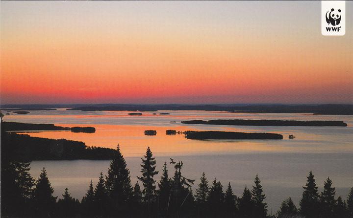
Finland is called ''the land of a thousand lakes,'' but at last count there were 187,888 of them - more lakes in relation to a country's size than any other. Indeed, with a population of about five million, Finland has one lake for every 26 people. Most of the lakes are in a region that stretches from above Kuopio in the north to Lahti in the south, and from Tampere in the west to Punkaharju and the Russian border in the east.
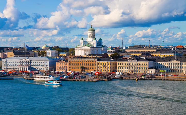
Finland borders Norway (727km) to the north, Sweden (614km) to the west and Russia (1,313km) to the east, with the Gulf of Finland to the south dividing it and the Baltic state of Estonia. It has a modest national population of just 5.2 million people, with its capital city, Helsinki, home to 10% of that figure.
Since it implemented huge education reforms 40 years ago, Finland's school system has consistently come at the top for the international rankings for education systems.
The mobile phone company Nokia has played an extremely important role for Finland. In 2000, Nokia produced 21 per cent of Finnish exports and paid €1.1-billion or 20 per cent of all corporate tax revenue. Then the smart phone wars began, prompting the rapid loss of market share to Apple’s iPhone and Google’s Android platform. In 2010, Nokia generated 13 per cent of Finnish exports and paid out just €100-million in taxes.
|
|
Finland was part of Sweden for seven hundred years, and through one hundred years governed by Tsarist Russia. The country achieved full independence in 1917 and quickly became more prosperous than Russia. Perhaps this was part of the reason why Stalin in November 1939 decided to attack Finland. He soon found out that the Finns are tough people, with deep knowledge of how the Russians operate. The Winter War was a fight to the death between small Finland and the mighty 'Evil Empire'. Stalin expected to conquer Finland already by the end of 1939, but the Finnish resistance stopped long the numerically superior invasion force. The Finns held out until 13 March 1940, when a peace agreement was signed. During much of the war Finland tried to negotiate through the Swedish government. Most of the inquiries resulted only in stricter Soviet requirements, and the peace was declared, Finland had to cede more land than what was in the original peace plan from the autumn of 1939. |
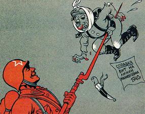
Had the Finnish forces not held out, however, it is likely that the whole Finland would have been occupied. Finland was forced to cede 10% of its territory and 20% of its industrial capacity, mainly forest industry, the Soviet Union. 10% of the population had to flee their homes and properties. The death toll for the Winter War is believed to have been about. 26,000 dead in Finland and the 270,000 on the Soviet side.
|
Why didn’t the Baltic States fight like Finland did? In a recently published book, '1939, The Year That Changed Everything in Lithuania's History ', the author Arnas Liekis presents an unflattering picture of the Baltic leaders at the time before World War II. In Lithuania, Latvia and Estonia, he says, no formal military resistance was provided, while Finland fought through their bloody winter war and survived the Soviet attack. The outcome was that brave Finland after the war evolved as one of the world's free, leading nations, while the Baltic states remained poor and forgotten under Soviet domination until 1990-91.
|
Helsinki and the distinctive Finnish architecture
|
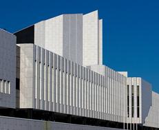
Finnish architecture is different, exciting. Modern. Only12 percent of the buildings were built before independence in 1917. The first international breakthrough for Finnish architecture took place at the World Exhibition in Paris in 1900, while national romanticism was still the dominant style. AlvarAalto (1898-1976) shows. He designed more than 500 buildings, about 300 of them were built, most of them in Finland, but also some in the U.S., Germany, Italy and France. Aalto's wide design activities ranging from urban planning and architecture to interior and furniture design, glass design (Iittala) and painting. |
|
|
|
One of the most impressive features of the Finnish capital Helsinki, is the seaward approach to the city. The numerous islands and islets are all beautifully green, very neat. Finland leads, also this way.
|
Helsinki was founded by Swedish King Gustav Vasa in 1550. The purpose was, curiously enough, to create a rival to the Hanseatic city of Tallinn.
At the beginning of the 1800s the city had still only 4,000 inhabitants. The change came when the Russians captured it in 1808 and Finland became a Grand Duchy under the Russian Tsar. In 1812 the Tsar decided that the Finnish capital was moved here from Turku on the southwest coast, probably because the city was closer to St. Petersburg. A new centre in the Empire style was built up around the Senate Square, with magnificent buildings, such as the Cathedral.
It's good to come to Helsinki. It is good to wander along the quays. See the huge ferries from Viking or Silja Line. Feel the good smell of the sea. Stroll along the Alexander Street and Mannheim Road. Sitting down with a cold beer in the park area Pohjoisesplanadi. The town centre here at the park is homogeneous neoclassical. One understands why the city was nicknamed the 'Nordic white city'. But Helsinki is perhaps even more famous for its numerous Art Nouveau buildings
(Finnish Art Nouveau) buildings from the early 1900's. These buildings are strongly influenced by the Kalevala, a very popular theme in Finland's national romantic art of that time. The master of Finnish Art Nouveau was the architect Eliel Saarinen (1873-1950), in this city known for his architectural masterpiece, the Helsinki main railway station. One would also not have walk many hundred meters before encountering Alvar Aalto buildings.
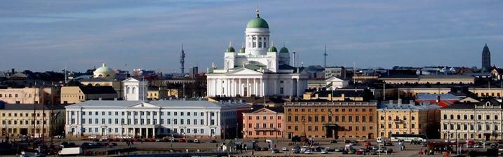
Seafront in Helsinki, with The Cathedral right behind.
Rovaniemi in North Finland claims to be the home of Santa Claus…
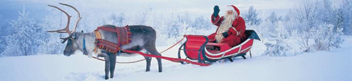
Rovaniemi is the capital of Lapland in Finland, located at the northern Arctic Circle. Lying at the junction of North and South on the border to the Arctic, Rovaniemi has become a modern town, full of life with its own unique characteristics.
There are eight different seasons this far north, each having its own type of daylight, temperature and natural phenomena. The changing seasons offer excellent settings for a whole variety of activities. During the frosty twilight, you can ride a snowmobile through snowy forests or over a frozen river, the Midnight Sun on the other hand, takes you cruising in a boat on the river. Each season offers an opportunity to experience the town in a totally different light.
Although Christmastime comes but once a year, in Rovaniemi you can experience Christmas throughout the year. Rovaniemi, in Finnish Lapland, is the hometown of Santa Claus who can be met on any day of the year at the Santa Claus Office on the Arctic Circle.
- Bookmark :
- Digg
- del.icio.us
- Stumbleupon
- Redit it

 WP-Plugin")

VilNews e-magazine is published in Vilnius, Lithuania. Editor-in-Chief: Mr. Aage Myhre. Inquires to the editors: editor@VilNews.com.
Code of Ethics: See Section 2 – about VilNews. VilNews is not responsible for content on external links/web pages.
HOW TO ADVERTISE IN VILNEWS.
All content is copyrighted © 2011. UAB ‘VilNews’.
[…] To read today’s travel report, click HERE […]
[…] Read more… […]